EMS IS YOUR GIS GEOSPATIAL SOLUTION PROVIDER
Based in Phoenix, AZ, EMS is a trusted geospatial services company serving the GIS community since 1995
GIS SERVICES AND ASSET CONVERSION
EMS provides a wide range of consulting services to clients nationwide. We specialize in enterprise-wide GIS consulting, spatial asset conversion, GIS Asset management software integration, and custom web-based data deployment.
Read on below to see more...
GIS SOLUTIONS
We deliver GIS-centric solutions that are efficient, cost-effective, and scalable for future growth. At EMS, we offer a full range of GIS services including:
- GIS needs assessment
- System & Database Schema Design
- Project implementation
- Field Asset Collection
- GIS Data Conversion from As-builts
- GIS Software installation and Technical support
- Custom GIS Application Development
- GIS InfoGraphic Support
- GIS Integrations with Microsoft 365
- Open Source development and integration
INNOVATION IN FIELD DATA COLLECTION: BikeRAC
EMS provides a full range of GIS asset collection services. By leveraging our eBike-based Rapid Asset Collection, or BikeRAC for short, we collect any field point to RTK accuracy. Through leveraging our friends at Bad Elf, Inc, our GPS needs are totally met.
We collect any spatial feature including (but not limited to!):
- Water Utility valves, hydrants. meters, connections
- Sewer Utility manholes, cleanouts, structures
- Storm Drain culverts, manholes, inlets
- Reuse Utility vaults, manholes
- Street Lights fixture type, wattage, pole characteristics
- Fiber Optic manholes, handholes
- Sidewalk Survey all aspects of current sidewalk and ramps
- Public Park Facilities all aspects of park facilities
- Signage posts, MUTCD codes
- and more...
BikeRAC is the affordable way to collect the data necessary to make your GIS centimeter-accurate! And all features will have Video and/or still photos as GIS attachments.
Call us today to start discussing your next geospatial data collection project.
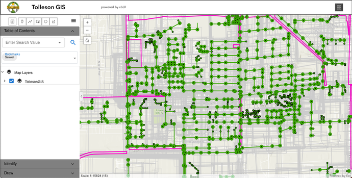
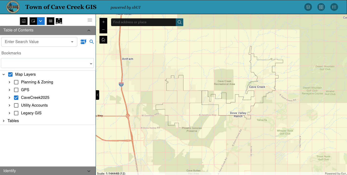
GIS DATA DEPLOYMENT AND FIELD EDITING
In addition to the services mentioned above, we assist clients in all aspects of data deployment and field editing. By leveraging Visual Studio custom development and the ESRI suite of tools, our clients are efficient both in the office and field.
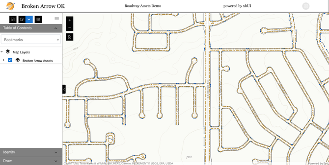
- EMSFieldView - Browser-based ESRI JavaScript viewer (shown to the left) and consumption of WMS
- EMSFieldMap - .NET client based on ESRI Runtime for windows-based GIS data collection and viewer
- ArcGIS Online integration, configuration, and deployment
- All aspects of ESRI Software installation and configuration (ArcServer, SDE, Portal)
- Custom widgets for WebAppBuilder deployed in Portal
- Custom Add-in tools for ArcMap and ArcPro SDK (Visual Studio 2022 C#)
- ESRI FieldMaps configuration, deployment, and workflow optimization
- Integrated GPS field data collection with FieldMaps and supporting maintenance activates
SOFTWARE, RESOURCES & PROFICIENCIES
Geospatial Software Resources and Proficiencies
- Esri ArcGIS Desktop Advanced concurrent licenses (Registered Developer)
- Esri ArcGIS Server Workgroup and SQL Server Enterprise
- OpenGeo Suite open source web server and developer SDK
- AutoCAD Map 3D (Registered Developer)
- Google API Developer SDK
- Microsoft SQL Server
- Esri ArcGIS Online Developers
- Quantum GIS (QGIS) open source Desktop GIS
- Google Maps & Bing Maps SDKs
- PostgreSQL/PostGIS
Web Development Environment
- Esri JavaScript API
- AngularJS MVC development environment
- Microsoft Visual Studio IDE
- Visual Studio Code (ESRI Portal Development)
- OpenLayers (open source JavaScript library for geospatial data)
UNMATCHED GIS SUPPORT
Our customer-centered approach to client support is what sets us apart from other companies.
Your business matters to us and we'll do what it takes to keep your your systems up and running.
With over 25 years of being in business here in the Valley, we service clients across the all 50 states.
SEE HOW
COMPANIES BENEFIT
FROM EMS GIS-BASED SOLUTIONS
Arizona Public Service Uses EMSFieldMap in Their Vehicles Across the State of Arizona
EMS customized several modules for their specific searching and display. Originally installed in 2007, APS relies on it to this day.
Infrastructure Management Services Leverages EMSFieldMap for Mobile Data Collection
EMS customized several modules for their specific mobile mapping and collection needs. IMS also uses the EMSOpenCloud web hosting.
City of Alameda, CA CMMS
Web Mapping
Alameda leverages the EMSWebMap Lucity integration to manage their field workorders. EMS created a full GIS system for the City and continues to support and maintain the Enterprise system.
Volusia County, Florida
Mosquito Abatement
Volusia County Mosquito Control leverages EMSFieldMap and EMSWebMap to manage their ground based treatment operations. These custom tools allow the department to define treatment areas, assign personnel, track spray operations live, integrate with their Lucity Work Order Management software, and summarize treatment data for each spray mission.
City of Mesa, Arizona Street Signals
The Mesa Transportation Department utilizes a custom web based inventory and maintenance management system developed by EMS.
City of Surprise, Arizona Permitting Application
EMS developed the Surprise Land Information System (LIS), a web-based application for the Community Development department that covers Development Agreements, Planning and Zoning, Engineering Reviews, Permits, Inspections, and Code Enforcement.
Pocatello, Idaho Enterprise GIS
EMS works with the Town of Pocatello, Idaho to provide GIS and software support for their Lucity Inventory and Work Order Management System.
Liberty Utilities
EMS converted the Liberty Water and Sewer utilities in each of the 13 states it serves across the country. Liberty relies on EMS to host and publish their GIS data to aid in the operations and maintenance of the system.
A Team P.A., Inc. (ATPAI), a Land Surveying firm, Uses EMSMobile for
Field Data Collection
Running in a disconnected mode, field survey information is collected and synced to a cloud server. A TEAM also leverages the EMSOpenCloud hosting for survey research.
Central AZ Water Conservation District (CAWCD) - Enterprise GIS
The CAWCD hired EMS to provide a custom application to manage their land leases and encroachments. They are also users of the EMSFieldMap software to view their Enterprise GIS data.
City of Peoria, AZ - Enterprise GIS Data Publishing
As long-time users of both EMSWebMap and EMSFieldMap, the City of Peoria relies on EMS software and support for their Enterprise GIS.
EPCOR Water -
GIS Consulting Support
EPCOR Water relies on EMS for GIS consulting and maintenance. They leverage EMSWebMap to view their Enterprise GIS data.

EXPERIENCE AND PARTICIPATION MATTERSDESIGN
The company principals, Martin Shaeffer, P.E. (President) and Phil Ponce, P.E. (Vice President), have over 60 years of combined expertise in engineering design, GIS, CAD, database design, and engineering solutions.
Phil Ponce has served as the AGIC Private Sector Representative board member since 2013 and has participated at the yearly AGIC conference every year since 1997. Do you remember Arc/Info running on Unix? We do, we've been involved with GIS technology since the mid-80s and have the scars to prove it!
We are ESRI Developers and regularly attend the ESRI User Conference and Developer's Summit to stay abreast of the constantly changing GIS tools and offerings.
We are heavily invested in Opensource tools such as QGIS and OpenGeo as a low-cost alternative to competing technologies.
Call us today and let us share our insight with you.